
Burdoin Mountain Hike
Burdoin Mountain Bench Hike
by Andy P. of GorgeConnection.com
This is the hike to see where every calendar shot of the Columbia Gorge that wasnt taken at or near Crown Point is.
The up and back to "The Bench" is a little over 6 miles round trip with an 1800 ft gain in elevation, or leave a car at the bottom and meet a ride at Courtney Rd. for a little over 4 miles in total.
Some things to know about Burdoin Mountain:
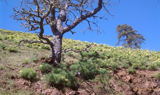
Wildflowers galore, which start around the first big spring rains, going through September or October. Wild parsley and many other varieties line the trails.
Ticks are out when it's warm enough, which is usually starting about April and going until the end of October. Be sure to check yourself upon your return home or periodically throughout the hike. They are most apt to hop on to Fido if he comes along, but they can also trampoline from him on to you hours later.
Tip removal thats worked for yours truly: Light a match and then blow it out. Take the match head to the butt end of the little bastard and make him uncomfortable. He may decide to drop out then and there, but it will usually just make him a cinch to pull out harmlessly. Dispose of him as you see fit (I prefer to drop them in a toilet and then laugh maniacally as I flush them down the tubes. Thats not creepy, right?)
Cows roam essentially the entire area of the hike. The gracious, GRACIOUS folks of Kreps Ranch allow passage onto and through this property, so do not look the gift horse (cow?) in the mouth. No Bulls are out, so it's all females and calves. The chances of actually running into a group are quite slim, however the chances of stepping in their, uh, leftovers is considerably higher.
Turkeys also roam these woods, but they are exactly what you think they are. Scared S----less of humans, harmless and tasty with gravy.
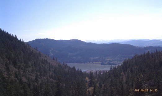
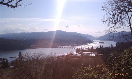
The word on photo opportunities is this... Just have your camera out the whole way up. Multiple different angles of Mount Hood, The Columbia and Hood River Valley are all in play if it's sunny.
At the top at the bench is the viewpoint of every Gorge calendar thats ever been made.
This route is a specific trail up the hill, but is one of nearly 50 different routes that criss-cross the hillside between Courtney Road and White Salmon. Nearly all the area on the hike is ranch or timber land, but there are scattered home sites.
Along the top of the ridge it can be notoriously windy at times, so check out the Columbia on the way up to the trailhead. If it's blowing on the river, it's blowing at the top.
From Portland, take I-84 E to the Hood River Exit. Cross the Hood River Bridge and turn right onto Hwy 14 to go through Bingen. 1.25m from the bridge fuel up at El Rinconcito Taqueria (114 W Steuben) before turning left up the hill at Jewett Blvd. Head ¾ of a mile up Jewett, Skyline Blvd will be on your right. Take Skyline up to where it splits. Immediately on your left is the parking and starting spot.
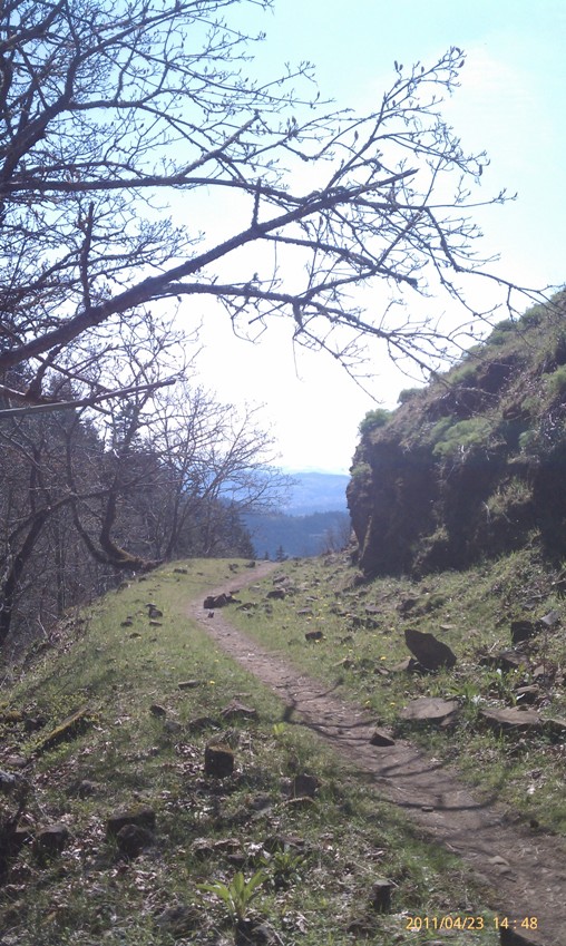
The first 500 yards is a nice rocky, steep warmup. At the crest, before the trail curves down and around into the woods, is a good shot of Skyline Hospital in the foreground with a long look westward down the Gorge.
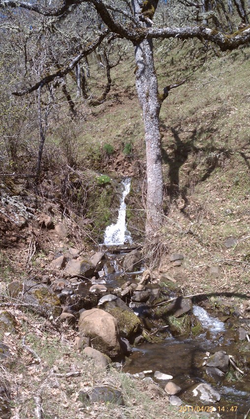
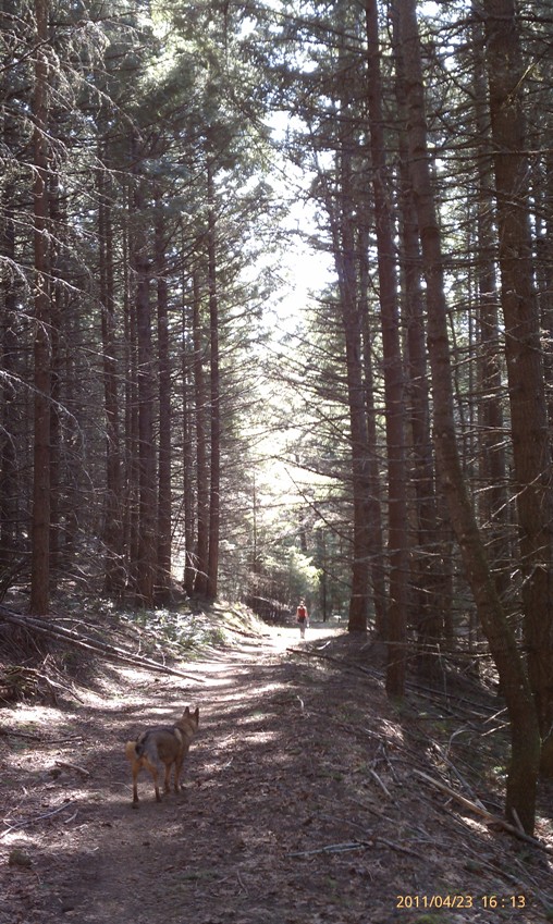
Next, you wind your way up the hill with Dry Creek below you on the right.
At the first switchback you can go to the right and down to a bridge over the creek that continues down another trail for another day. Switchbacks again a short while later and crosses another creek followed by coming into a wide open meadow-like area with lots of flowers.
The trail winds back into the woods crossing "Upper" Dry Creek and a tree lined section with periodic Gorge views to the west. Within a few hundred yards is another junction on the trail with one route curving around the side of the hill and the other switch-backing to the Northwest. Continuing with the switchback theme through some more forested area, finally crossing ANOTHER creek. Very hard to Google Earth the route because of the tree cover. Could be dry creek again, could be the Mississippi for all I know. Scenery shots coming fast and furious now (See below). After a short while, the last of switchback mania appears with a very small green meadow on the left and the trail continuing forward or reversing field back to the E.
The homestretch is here, gradually winding its way along the rim of the ridge with wide open photo opportunities and then a zig-zag little jaunt through the trees before coming out into a can't miss pinnacle of 200+ degree views. The Hood River Valley is the jewel here but Hood is there, as is Mt. St Helens on a clear enough day.
Downtown White Salmon is laid out almost beneath you and parts of Bingen are viewable as well. Many, many other hikes are viewable from here, including Mount Defiance, Mitchell Point, Underwood Mount, are just a few of the nearby treks.
Take your time. Soak in the sights. When you decide to get up again, its close another mile to continue around the bend and arrive at Courtney Road where there are lovely eastern views. Take care to avoid the homeowner that is next to the road at Courtney.
Enjoy and don't forget to check out pictures taken along the hike below!
Title Link

"On The Lighter Side"
The Dalles Murals Loop - For those looking to take a stroll without inclines and wilderness. Located in downtown The Dalles, this 2 mile stroll is under rated to say the least!
Link