
Mitchell Point Hike
Mitchell Point is a nice combination hike that has a moderate difficulty and rewards you with a 360 degree over look of the Central Columbia Gorge. As with a lot of Gorge trails, it's an out and backer. This trek is hikable unless there is snow You may hike it 5 out of 7 days and see a total of 6 people.
As you head up, take note of the wind. Check out what the Columbia is doing. If you see white caps on the river, then it's going to pretty windy up on the point. If you're hiking this trail during Spring or Fall, long sleeves would be smart, while in the Summer, anything goes.
If you choose, you can pull over on I-84 Eastbound at exit 58 and park in the lot. Taking this route is a short but steep route to scenery. With 1200 feet of elevation gain in just 1.3 miles, only the steel-calved need apply.
Check your calves. Ill wait.
Oh you do then! Ok, you need not read further then. For the non steel calved (like the author), read on...
Head past the freeway stop a couple more miles and pull into Hood River (Exit 64). Off the freeway, make an immediate right onto Country Club Road.. Stay on Country Club for 2.6 miles until you see Post Canyon Drive. Take a right on Post canyon and continue until the road turns to gravel and heads into the woods. You may pull over anywhere along there. Since Post Canyon is a popular recreation place for mountain biking as well as hiking, there may be others parked as well. Click here for mountain biking info on Post Canyon. Hop out, lock up, and youre good to go!
Start up Post Canyon Rd. and keep your eyes peeled for mountain bikers coming down the myriad of trails that criss cross the area.
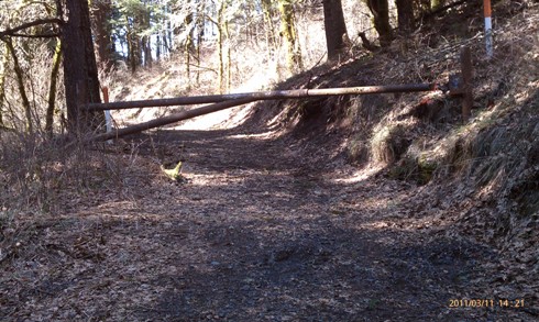
A little over a mile up, you will come to a bend where on the right side you'll see a gate (not locked .ever). Do not worry about trespassing, this is timber company land for the rest of the day.
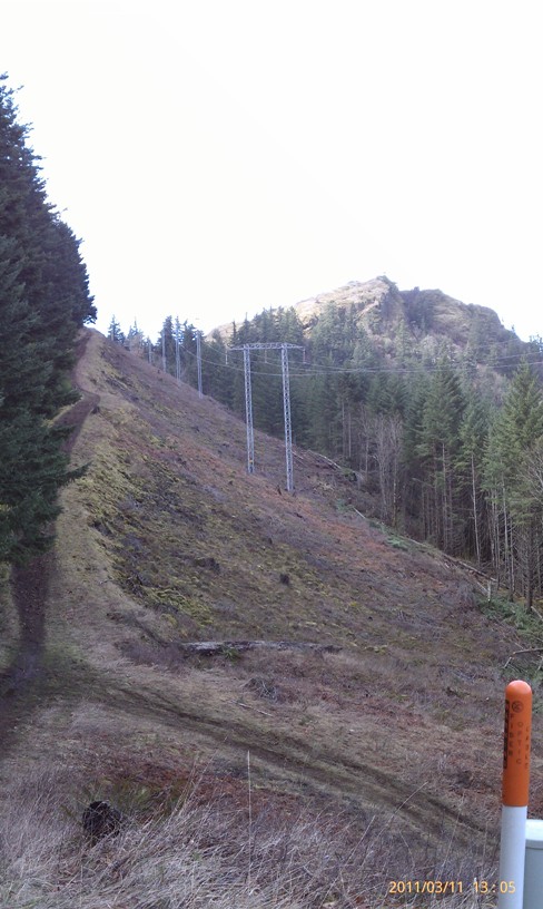
Veer off the road and follow the trail until you're standing beneath power lines. From this point on, youll be able to have Mitchell Point line of sight for nearly the rest of the way.
Straight across the power lines, the trail continues down hill becoming a little steep and weather-depending, VERY slippery. Slow and steady yourself until the bottom.
You'll rejoin the power lines and parallel back up the hill gradually for about a third of a mile. Just past the turn to the point, youll be able to see the I-84 rest stop trail coming up over the hill from the west to meet you.
Continuing on here ties you back into the Post Canyon Road much farther up the hill, as well as connecting to a bunch of other routes. But thats another story for another day. Mitchell Point is a just a few (steep) short (hundred) feet away.
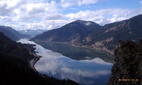
Stretch, hydrate, pictures, whatever is needed here. You are almost to the promised land. Just dont let the views distract your footing as you climb the last few hundred feet to the point. The top is a small rocky area and not exactly comfortable, in addition to the fact that taking the wrong step will end up being your last step.
There is room for about six people (comfortably) to sit and take in the sights, have lunch, play guitar, and so forth.
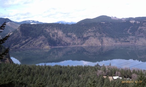
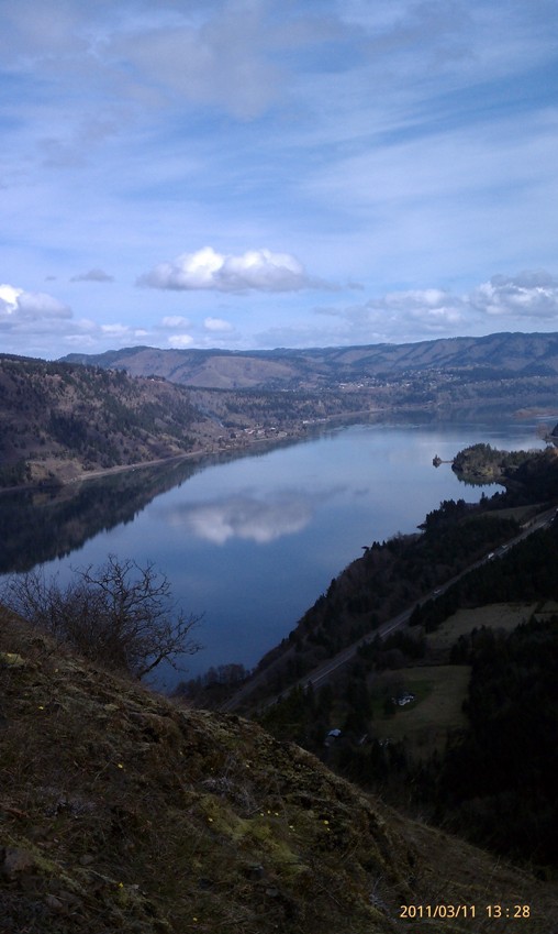
Lining the last few hundred feet are lots of grass widow flowers but nothing else that blocks your view. To the West, you can see down to Stevenson, Washington and Dog Mountain. To the East, the White Salmon Bluff and Burdoin Mountain.
Head back down the way you came for your return trip.
NOT recommended at the top of Mitchell point: Rolling down the grass, playing catch, watching thunderstorms.
From parking to the point and back, counting 15 minutes at the top, should take you right around 2 hours. This does depend on your level of fitness and propensity for picture-taking.
Afterwards, come back into town with an appetite and head to Full Sail Brew Pub, or if you're in a hurry, the Hood River location of Pizzacato.
See pictures below!
Title Link

"On The Lighter Side"
The Dalles Murals Loop - For those looking to take a stroll without inclines and wilderness. Located in downtown The Dalles, this 2 mile stroll is under rated to say the least!
Link